
When I first started figuring out the whole full-time travel thing, I assumed I’d just use Google Maps and wing it. That lasted about three days before I realized there’s a whole ecosystem of apps and tools that people rely on to find camping, dodge low bridges, get wifi, and save money on diesel. So I went down the rabbit hole and tested pretty much everything.
The apps that matter most for skoolie travel are iOverlander for free camping spots, Campendium for campground reviews with cell signal info, a route planner that accounts for vehicle height and weight (not just Google Maps), GasBuddy for cheap diesel, and either Starlink or a solid mobile hotspot setup for internet. Throw in a Harvest Hosts membership and the AllStays app and you’ve got a toolkit that covers about 95% of what you’ll run into on the road.
iOverlander (Free Camping and Overnight Spots)
I heard about iOverlander from a guy in an online forum who’d been living in a converted transit bus for two years. He said it was the single most useful app on his phone, and after using it for a while I get why.
iOverlander is a free, community-driven app where people drop pins on a map for places you can camp or park overnight. We’re talking BLM land, national forest dispersed camping, Walmart lots, rest areas, water fill stations, dump stations, free camping on public land — all of it, marked by people who actually stayed there. Each spot has reviews, photos, and usually some notes about whether the road in is passable for bigger vehicles. (See our guide on Can You Park a Skoolie at an RV Park? for more on this.)
The thing that makes it different from just googling “free camping near me” is that the data comes from van lifers, bus people, and overlanders who actually parked there. So the reviews mention stuff like “tight turn at the entrance, wouldn’t bring anything over 30 feet” or “cell signal was garbage but the views were worth it.” That’s the kind of info you can’t get from a campground’s own website. (See our guide on How to Find Free and Cheap Camping for Your Skoolie for more on this.)
It’s completely free. No subscription, no premium tier. The catch is that the data is only as good as the community contributing to it, so popular areas have tons of pins and rural backroads might be sparse. But for the western US especially, it’s incredibly thorough.
Campendium (Campground Reviews with Cell Signal Data)
So here’s where Campendium fills a gap that iOverlander doesn’t really cover. Campendium focuses more on established campgrounds — RV parks, state parks, national park campgrounds, Corps of Engineers sites — and the reviews include something I haven’t found anywhere else: cell signal reports by carrier. (See our guide on Where Do You Park a Skoolie Long-Term? for more on this.)

When you’re looking at a campground on Campendium, people leave reviews that say things like “Verizon had 3 bars LTE, T-Mobile was useless, AT&T was spotty.” If you work remotely, that information alone is worth the app. I can’t tell you how many times I’ve read about people showing up to a beautiful campground only to realize they can’t get online to do their job.
The app is free for basic use. There’s a paid “Campendium Pro” tier that runs about $30/year and gives you offline maps, filters, and some extra features. Honestly the free version does most of what you need, but if you’re full-timing and using it every week, the Pro version pays for itself in convenience.
One thing I noticed is that Campendium tends to have better coverage for paid campgrounds and established sites, while iOverlander is stronger for boondocking and free spots. Most full-timers I’ve talked to use both. They’re solving different problems.
Google Maps vs Trucker Path (Route Planning for Big Vehicles)
Alright, this one is a bigger deal than people realize and it’s something I didn’t think about until I started reading horror stories from bus owners.

Google Maps doesn’t know you’re driving a 35-foot, 11-foot-tall, 26,000-pound vehicle. It’ll route you down a residential street with low-hanging trees. It’ll send you under a bridge with a 10’6″ clearance when your bus is 11’2″. It’ll put you on a road with a weight limit that your bus violates. Google Maps is built for cars, and it works great for cars. It’s not built for you.
Trucker Path is one of the better alternatives. It’s designed for commercial trucks, which means it factors in vehicle height, weight, and length when calculating routes. It also shows you truck stops, weigh stations, and rest areas along your route. The interface isn’t as pretty as Google Maps, and the turn-by-turn directions can be a little clunky, but it won’t send you under a bridge that takes your roof off.
There are other options too. RV Trip Wizard lets you input your vehicle specs and plans routes accordingly. Hammer (formerly CoPilot GPS) is another one that accounts for vehicle dimensions. Some people use a combination — plan the route in a truck-friendly app, then switch to Google Maps for the last few miles in town where clearance isn’t an issue. (See our guide on Where to Park a Skoolie: The Complete Guide for more on this.)
I talked to one bus owner who clipped an overpass sign his first month on the road because he trusted Google Maps. Didn’t damage the bus badly, just scraped up his roof rack, but he said it scared him enough that he never used Google Maps for primary navigation again. That story stuck with me. The apps might cost $10-$40 for premium features, but that’s a whole lot cheaper than a new roof AC unit or worse.
GasBuddy (Finding Cheap Diesel)
When you’re getting 7-10 miles per gallon and your tank holds 60+ gallons, even a $0.20 difference in diesel price matters. That’s $12 per fill-up. Do that twice a week and you’re saving over $1,200 a year just by being strategic about where you fuel up.
GasBuddy shows you gas and diesel prices at every station along your route, updated in near real-time by users reporting what they paid. You punch in your location or your route and it shows you who’s cheapest. Pretty straightforward.
A few things I picked up from other bus travelers though. Truck stops often have better diesel prices than regular gas stations because they move more volume. Pilot, Flying J, Love’s, and TA/Petro are the big chains, and most of them have loyalty programs that knock a few cents off per gallon. The Pilot Flying J app in particular stacks nicely with GasBuddy — use GasBuddy to find the cheapest station, then use the Pilot app for their loyalty discount on top of it.
Also, and this is one of those things nobody mentions, the diesel pumps at truck stops are on the truck side, not the car side. If you’re pulling into a regular gas station for diesel, you’re often limited to one or two pumps and they might not have high-flow nozzles. At a truck stop, you pull up to the truck lanes and fill up at the high-flow diesel island. Way faster, and it’s what your bus was designed to use anyway.
Harvest Hosts and Boondockers Welcome Apps
These two are membership programs, not free apps, but they come up in pretty much every conversation about finding places to stay.

Harvest Hosts ($99/year) gives you access to a network of wineries, breweries, farms, museums, and other private businesses that let you park overnight for free. Well, “free” meaning you’ve paid the membership fee and the expectation is you’ll support the host’s business — buy a bottle of wine, grab some produce, eat at their restaurant. It’s a cool concept and the spots tend to be way more interesting than a Walmart parking lot. I’ve seen people post about staying at lavender farms in Oregon and working cideries in Vermont. Beats a rest area. (See our guide on Can You Park a Skoolie in a Regular Parking Lot? for more on this.)
Boondockers Welcome ($79/year) is more like staying on someone’s private property. Members offer their driveways, farms, ranches, and land for travelers to park on. Some hosts have hookups, some don’t. It’s a little more informal than Harvest Hosts and the experience really depends on the individual host.
Now, are they worth it? For full-timers who are constantly moving, probably yes. If you use Harvest Hosts even ten times a year, that’s under $10 per night for a unique place to stay. For weekenders or people who mostly stay in one area, you might not get enough use out of them to justify the cost. Both apps let you browse available locations before you commit, so you can check if there are hosts along your typical routes before buying a membership.
Starlink and Mobile Hotspot Management
This is the question I see more than almost anything else online. “How do you get wifi in there?” and “What do you do for Wi-Fi?” and “How do you pay your bills online, check your checking account?” It all comes down to the same thing — internet access on the road.

We’ve got a full article on getting internet and wifi in a bus, but let me cover the app and tool side of it here.
Starlink changed the game for full-time travelers. The mobile/roam plan runs about $120/month and gives you satellite internet that works basically anywhere you have a clear view of the sky. Download speeds vary — sometimes 25 Mbps, sometimes 100+ — but for remote workers who need to hop on video calls from the middle of nowhere, it’s the difference between being able to work and not being able to work. I talked to one couple who both work remote tech jobs from their skoolie, and they said Starlink paid for itself the first month because they stopped having to drive to town every time they needed a stable connection.
The hardware costs around $599 for the dish and router. It’s not small — you need to mount it or set it up outside with a clear view of the sky. Some people permanently mount it to their roof, others set it on a tripod when they’re parked. The dish needs power, so make sure your solar and battery setup can handle the draw (it uses about 50-75 watts on average).
For cellular hotspots, the management side is about knowing which carrier works where you’re going. T-Mobile, AT&T, and Verizon all have different coverage maps, and where one is strong another might be dead. Some people carry two SIM cards from different carriers and swap based on where they are. Others use a dual-SIM cellular router like the Pepwave that can switch between carriers automatically.
The practical setup for most full-timers ends up being Starlink for rural areas and boondocking, plus a cellular hotspot for cities and towns where Starlink might be blocked by trees or buildings. Between the two, dead zones almost disappear. Budget about $150-$200/month total for both if you go that route.
AllStays Camp and RV (The Paid App Worth It)
So I saved this one for last because it’s the one app I keep hearing full-timers say they can’t live without, even though it costs money upfront.
AllStays Camp and RV is a one-time purchase of about $10 on the app store. No subscription, no recurring fees, just the one purchase. And what you get is essentially every camping and RV-related location in the country on one map. Campgrounds, RV parks, rest areas, Walmart lots, dump stations, propane refill stations, low clearance warnings, weigh stations, diesel stations, water fill points, truck stops, and a bunch more.
The reason people love it is that it consolidates everything. Instead of checking iOverlander for free camping, then Campendium for campground reviews, then GasBuddy for fuel, then a separate app for dump stations, AllStays puts it all on one screen. You can filter by what you need — show me campgrounds within 50 miles that have full hookups and accept rigs over 35 feet — and it pulls up your options.
It’s not perfect. The reviews aren’t as detailed as Campendium and the free camping spots aren’t as comprehensive as iOverlander. But as an all-in-one reference tool, nothing else comes close. I think of it like this: iOverlander and Campendium are your specialists, and AllStays is your general practitioner. You want all three.
One more thing worth mentioning — AllStays also shows you low clearance bridges and overpasses on the map. So even if you’re using Google Maps for navigation, you can cross-reference your route on AllStays to check for any clearance issues. Not a replacement for a proper truck GPS, but it’s a nice safety net.
Finding Your Community on the Road
One question I saw that stuck with me was someone asking, “how do we find these communities?” They were a van lifer trying to connect with other mobile dwellers, and it’s a real concern. You can feel isolated out there if you don’t know where to look.
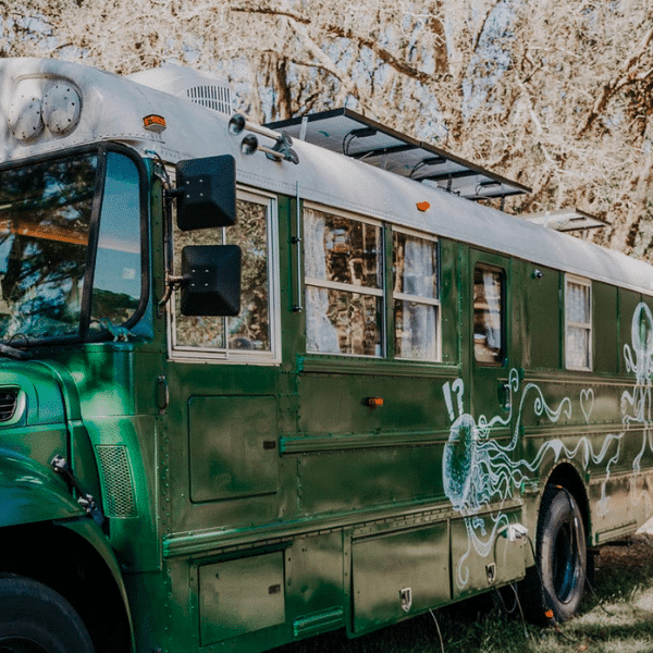
The apps I’ve covered here actually help with this more than you’d expect. iOverlander’s popular spots tend to become informal gathering places. Harvest Hosts events bring travelers together. Campendium’s forums have local meetup threads. But beyond the apps, Facebook groups like “Skoolie Convoy” and “Bus Life Adventure” organize caravans and meetups throughout the year. Vanlife and skoolie rallies happen in places like Quartzsite, Arizona every winter, and the RTR (Rubber Tramp Rendezvous) draws thousands of vehicle dwellers to the desert each January.
The community exists. You just gotta know where to find it, and honestly, once you start using these apps and showing up to the popular spots, you run into the same people over and over. That’s how this lifestyle works — the road is smaller than you think.
So Here’s What I’d Actually Download
After digging into all of this, here’s where I landed. You don’t need twenty apps on your phone. You need five or six good ones and the sense to use them before you start driving for the day.

iOverlander and Campendium cover your camping needs — free spots and paid campgrounds, respectively. A truck-friendly navigation app keeps you from losing your roof to a low bridge. GasBuddy saves you real money on diesel over time. And your internet setup, whether that’s Starlink or a cellular hotspot or both, keeps you connected to work, banking, and the rest of your life.
AllStays ties it all together as the Swiss army knife you check when nothing else has the answer. And if you’ve got the budget for Harvest Hosts, it opens up some genuinely cool overnight spots you’d never find otherwise.
The real trick isn’t having the right apps though. It’s building the habit of checking them the night before you move. Look at your route tomorrow, check clearances, find your camping spot for the next night, see where the cheap diesel is along the way. Twenty minutes of planning saves hours of stress. That’s what I kept hearing from everyone I talked to, and it makes sense once you think about it.